Facilities & Directions
MMT Tucson Offices
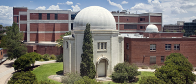
Steward Observatory, University of Arizona.
Driving directions from airport to the town offices:
- Exit airport and head NORTH on S. Tucson Blvd for around 3 miles
- Continue on E. Benson Hwy for half a mile
- Turn RIGHT onto S. Campbell Ave/ S. Kino Pkwy and continue onto N. Campbell Ave for a total of 4 miles
- Turn LEFT at E. 3rd St then RIGHT onto N. Cherry Ave.
- Steward Observatory will be on your left and the MMT Offices are on the 4th Floor
- There are a number of parking lots near the offices
MMT Observatory, Mt. Hopkins
| Quantity | |
| Elevation | 2606m (8550 ft) |
| Latitude | +31d 41′ 19.6 |
| Longitude | 110d 53′ 04.4″ |
| Time Zone | GMT +7 hours (MST) |
| Median Seeing | 0.7″ (FWHM) |
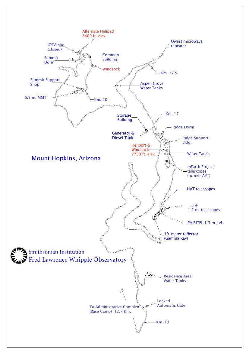
Facilities at the summit: Telescope, Control room, full self-service kitchen (including: oven, microwaves, fridge, freezer, dishes & silverware etc).
Facilites just below the summit (within walking distance): common building with full self service kitchen (including: visitors food storage, fridges, freezers, microwaves, oven), clothes washing facilities, cable television, library, wireless internet & pool table. Full dorms are just beside the common building.
Visitors must bring all food supplies with them. The nearest grocery shops are in Green Valley.
Driving directions from Tucson airport to the MMT:
- Exit airport and head NORTH on S. Tucson Blvd for around 1 mile
- Turn LEFT on Valencia to travel WEST for 3 miles.
- Turn LEFT on the I-19 S towards Nogales until exit 56 (Canoa Road)
- Follow the remaining directions below for the final directions to the MMT.
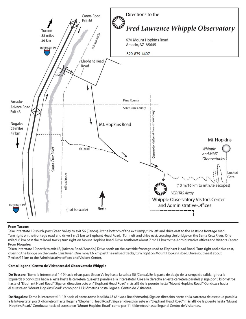
Driving directions from Tucson:
- The MMT is more than 43 driving miles south of Tucson
- From the University of Arizona take Speedway Blvd WEST towards Interstate 10 (I-10) (2 miles)
- Turn LEFT at N. Freeway Rd/ N Fwy, then take the ramp on the LEFT onto I-10 East
- Take exit 260 to merge onto I-19 South toward Nogales. Remain on I-19 for 28 miles
- Take exit 56 (Canoa Road). At the end of the exit ramp, take the 4th exit from the roundabout to cross under the freeway to the Frontage road on the east side.
- Turn RIGHT along the Frontage Road and drive for 3 miles.
- Turn LEFT onto Elephant Head Road. Continue east for 1.5 miles, crossing the Santa Cruz River and railroad tracks.
- Turn RIGHT onto S. Mt. Hopkins Road and continue for 7 miles to reach the Administrative Complex/Visitors Center (sometimes referred to as the “Basecamp”).
- STOP at the Administrative Complex and collect a radio to communicate with other traffic on the narrow mountain road.
- The mountain road is public access until a locked gate at Kilometer marker 13. The combination for the gate will be supplied by MMT staff.


